

Rock Island State Park
is a must see for waterfall hunters.

There is no question that the quest for hydroelectric power drastically changed the landscape of Tennessee. I appreciate that many lost their homes, and whole towns disappeared due to the push for cheaper energy. Rock Island is a product of damming the rivers and creating changes to the hydrological flow of the area. Some will say these aren’t “real” waterfalls, because they were created due to the intervention of man. As long as there are real rocks with real water coming over them, that is real!
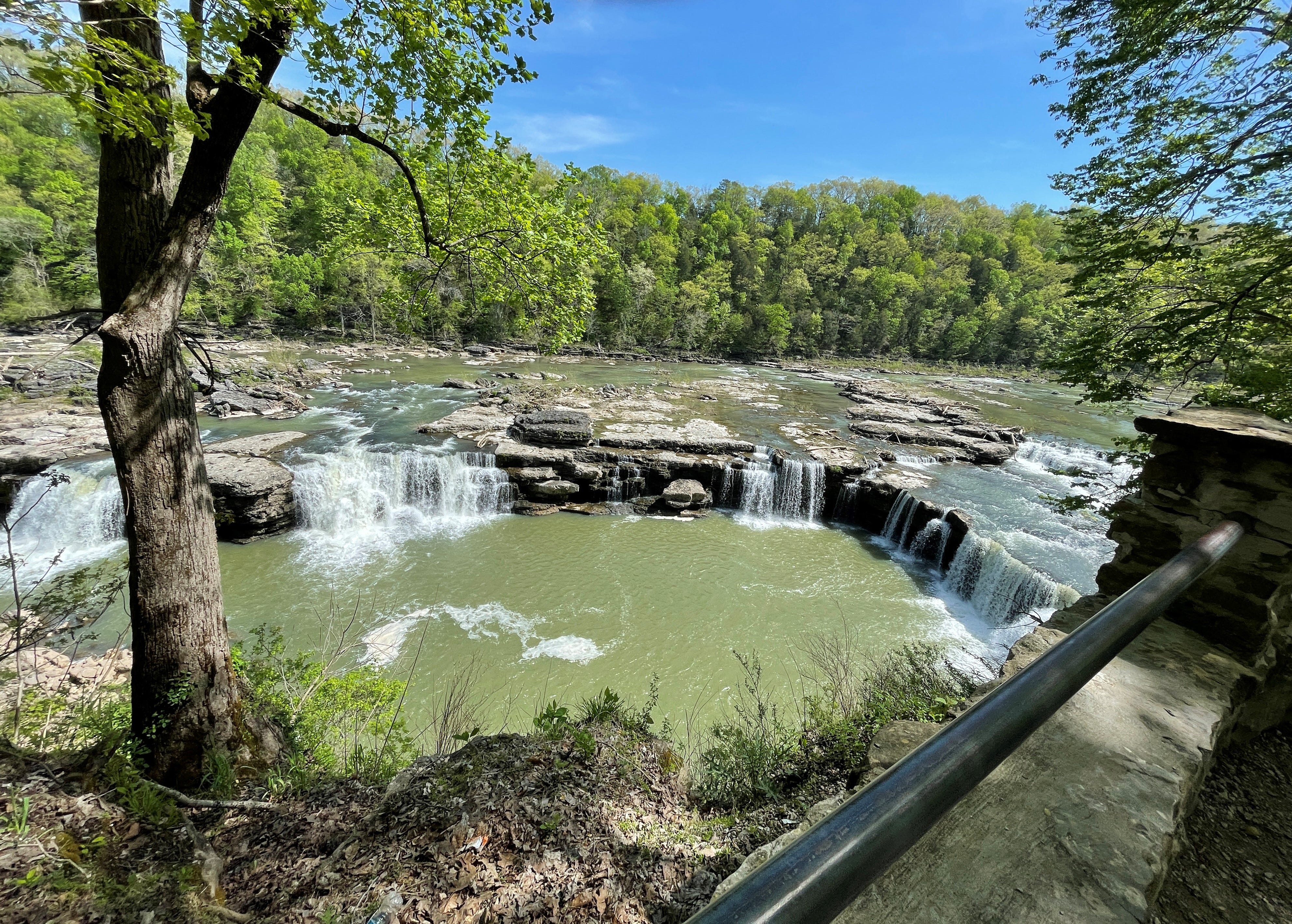
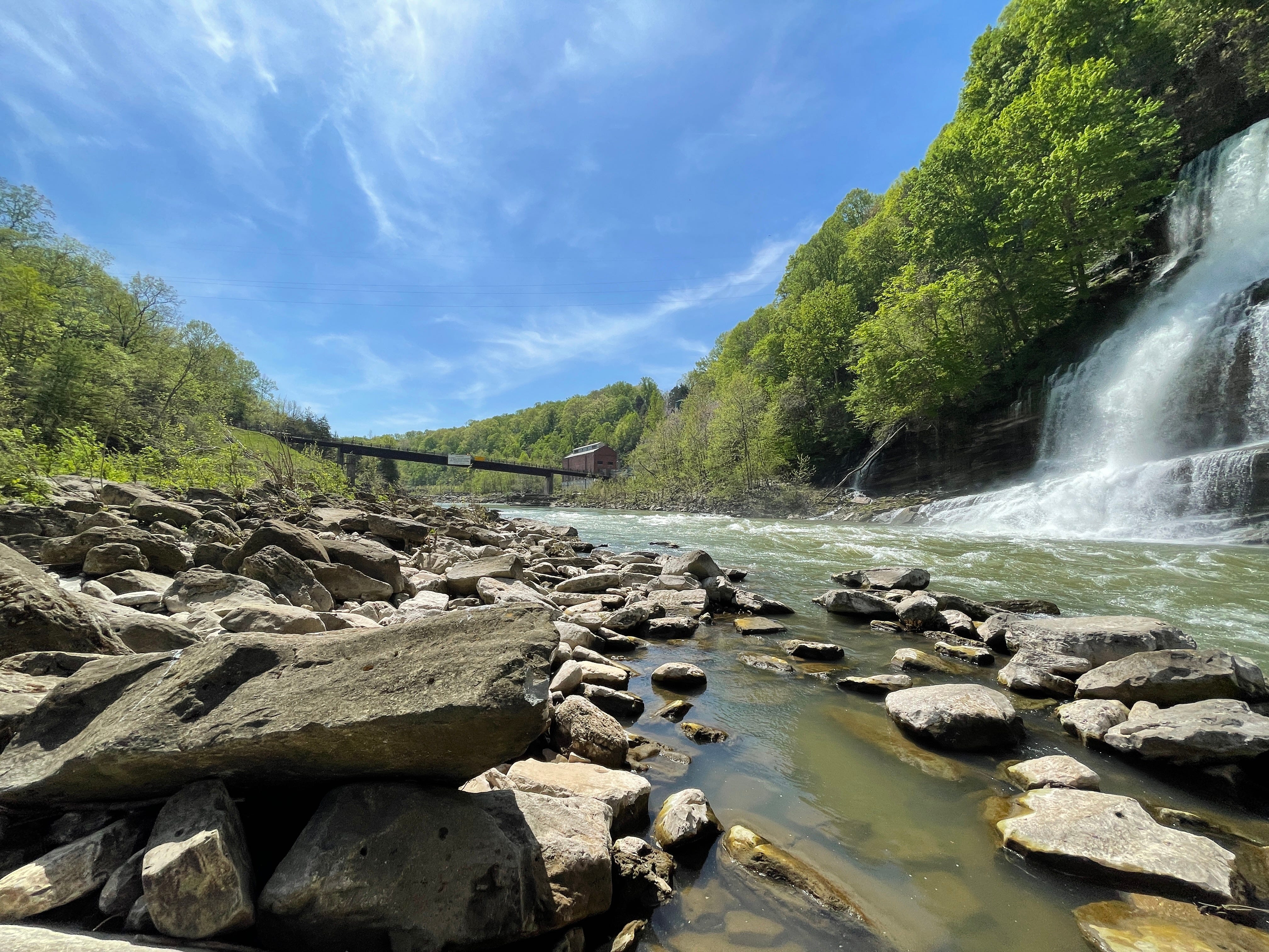
My friend Samantha and I took off last week to check out Rock Island. The route we took from our town was really beautiful-no interstate at all. When we arrived at Rock Island, we saw at the ranger station that the gorge access was closed. Yikes. I don’t know about you, but going to the bottom is really the highlight, so I had wished I had called ahead. Access is limited when the Tennessee Valley Authority will be releasing water through the dam. We drove to the parking area at Great Falls. Great Falls is beautiful from above, but there wasn’t a whole lot of water coming through at the time.
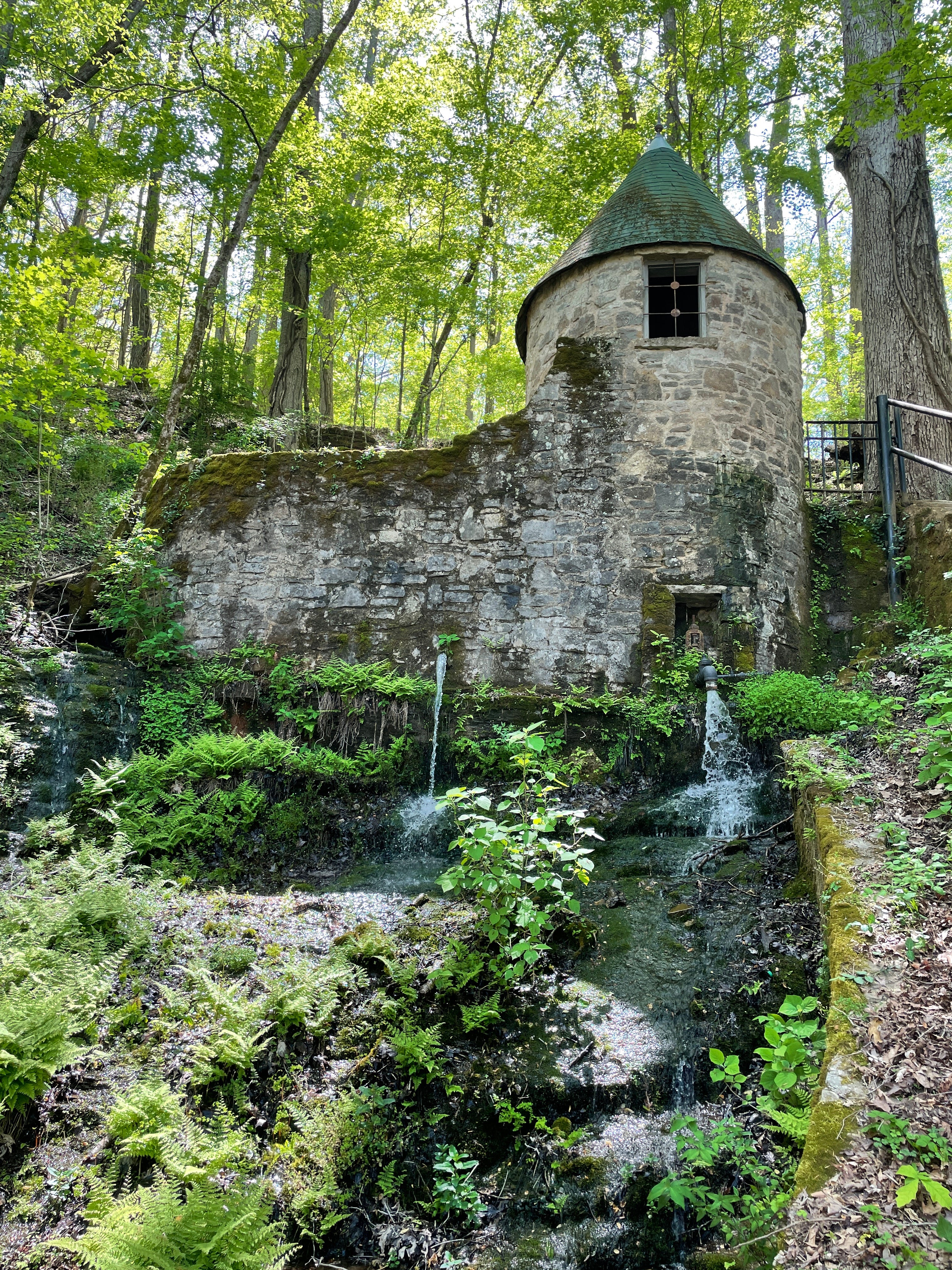
There is also a very cute pump house across the highway from Great Falls. The Spring House is like a fairy castle, and used to act as a reservoir. It still captures beautifully clear water-definitely walk up and get a closer look.
While I was busy pouting because we couldn’t get to the bottom of Great Falls, the alarms started to sound, meaning a release of water was imminent and everyone should leave the gorge. It was honestly a little creepy, so we didn’t stay long and took off to go around the park to get to the other falls.
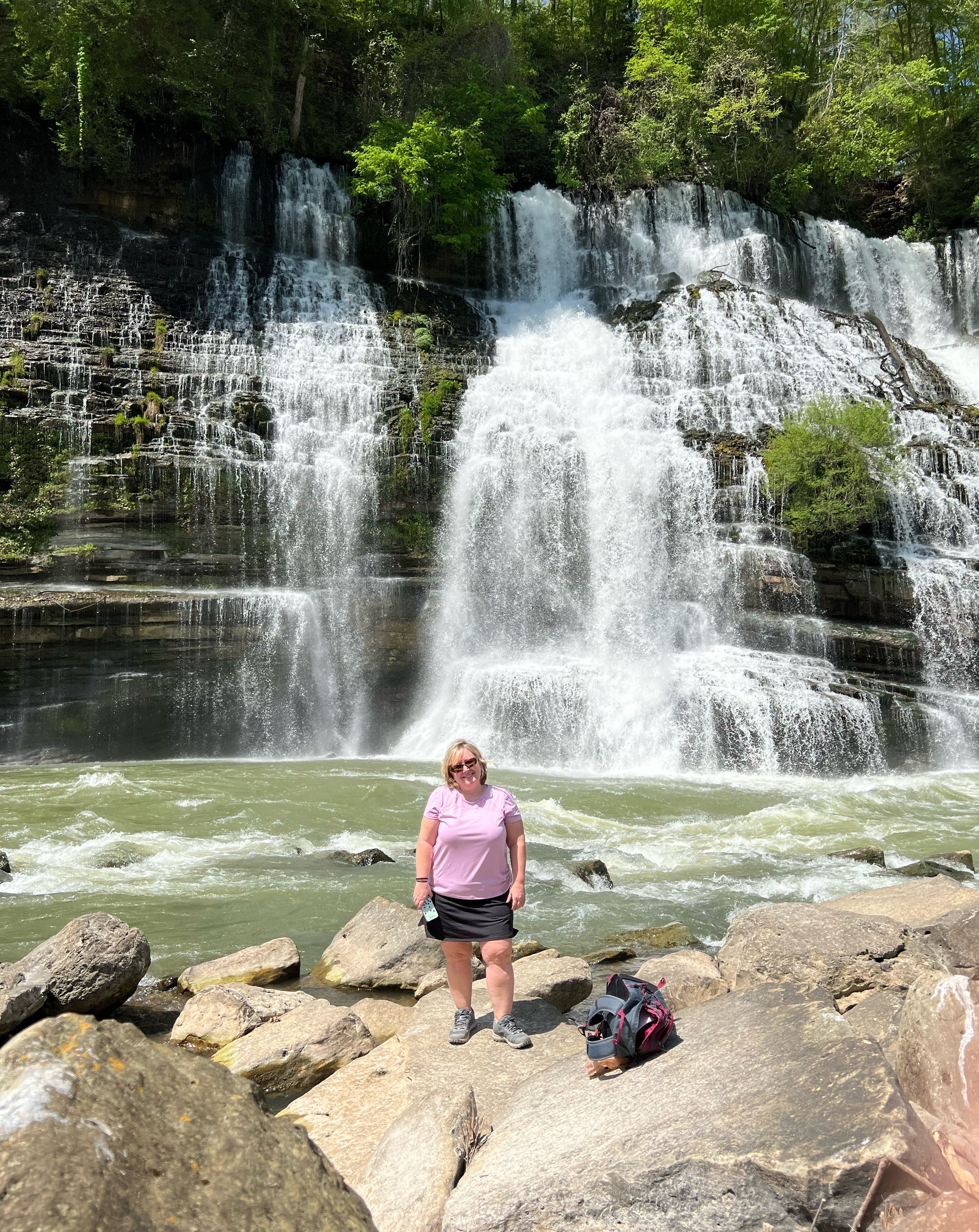
The best view of Twin Falls is from across the river. We parked and went down to the river. You can see the falls beautifully from the shore, but we wanted to get as close as we could, so we were faced with a little rock scramble. Standard rules apply for Rock Island-closed toe shoes, water, and sunscreen.
Twin Falls is an 80ft waterfall that comes out of the rocks, not from a creek. The damming of the Collins River filled natural caves, and the water flows out of the cracks. This does not seem like a good place to swim-the water is just flowing way too fast. You can still get wet from the mist off the falls, and some shallower places at the edge. I am thinking if you are in this area and the sirens go off, you need to move back to the riverbank. Samantha and I were trying to figure out how that one tree survives in the middle of the waterfall…
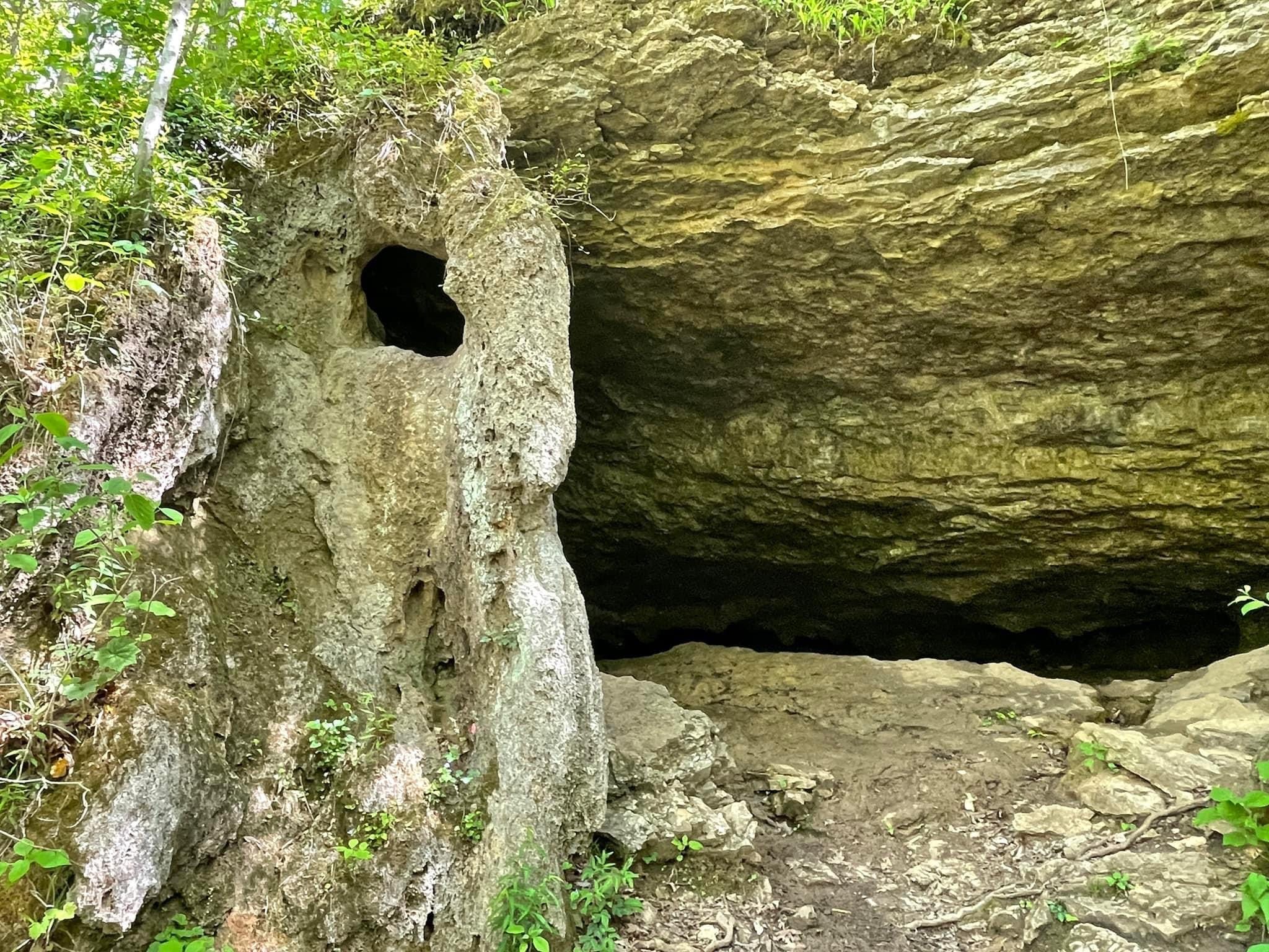
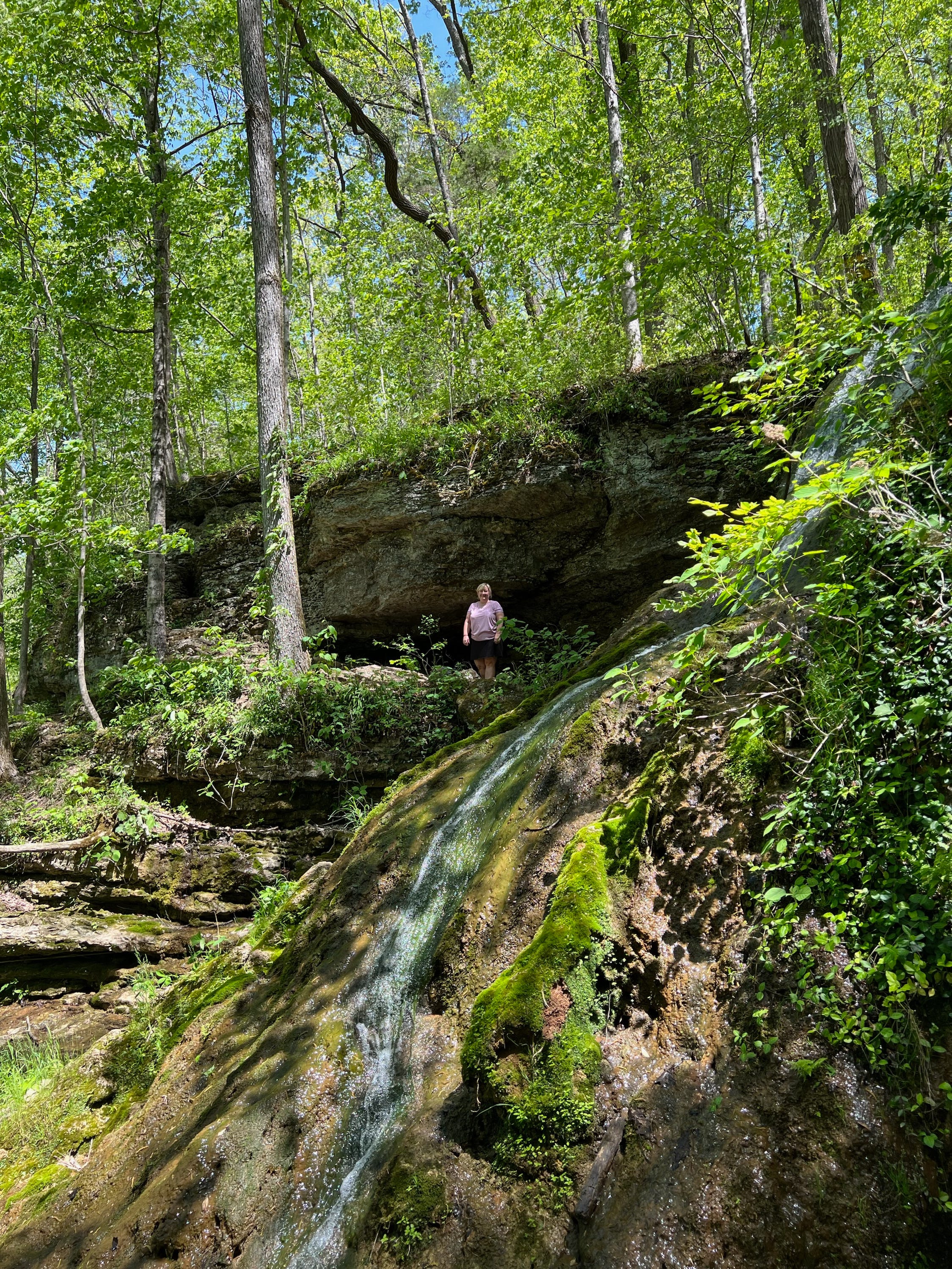
From Twin Falls, the Downstream Trail is about 1.5 miles. You really have to be looking down a lot-tons of roots, but overall pretty flat. It has many scenic views, and the sound of water is never far away-the cliffs along the Caney Fork River have so much water flowing out of them. Along the trail, there is another waterfall. Tennessee Landforms does not have this fall named, but the arch right next to it is called Little Falls Arch. So to me that makes this Little Falls…anyway there is also a very cool cave you can walk into.
We had lunch on a nice cliff toward at the end of the trail where it turns into a loop. It was a great view, and a nice place to relax. We were there several hours, and I was so excited that even with the gorge closed, it turned out to be a great day. Samantha says this is her favorite falls yet!
Beautiful!! And so interesting… I love the castle and cave!