Ranger Falls-success at a price
in Tennessee's newest State Park, Savage Gulf.

This post is a hard one. If you saw my post from May 15, you know there is some history here with me and Ranger Falls. I really don’t like to fail. Sharon and I put this on our list to make sure we went back when it was cooler. I knew we could do this, and check this elusive waterfall off my list. Well. (spoiler alert) We did get there, but at a definite price to my body and my ego. This is a place where I am never, ever going back.
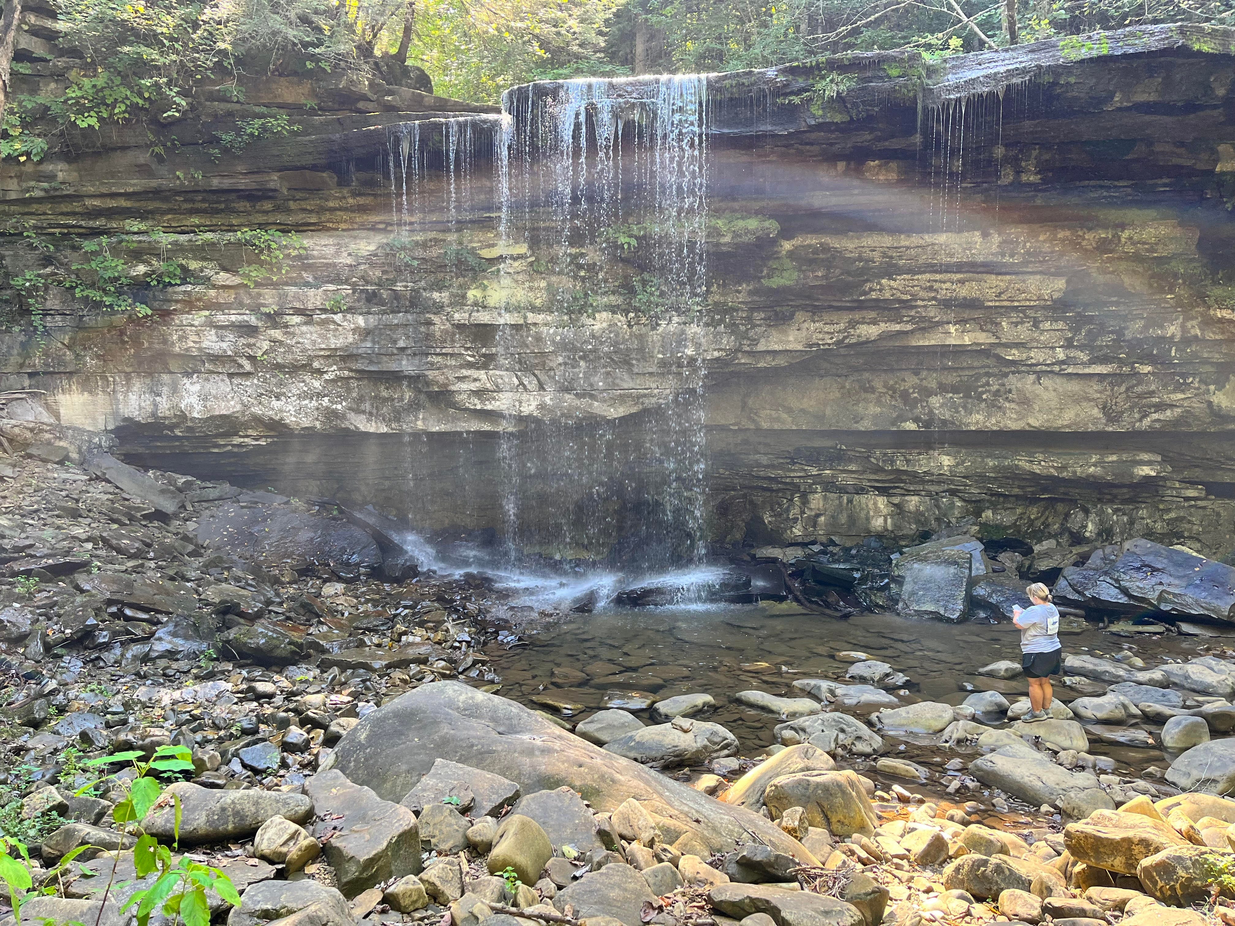
There is a lot to unpack here. Let’s start with the picture of success! Me at Ranger Falls! I am fortunate that my hiking buddies (this time Sharon) like photography and always take a special picture. Not a ton of water but still a beautiful scene. We were literally miles away from civilization, and you could feel the age and isolation of this place. I filled a water bottle here, just in case I needed it. It was as clear as the water I bought from the store. But the ranger recommended not to drink without treatment. So-Christmas list-water filtration tablets…
The plan for the day was to go to Laurel Falls, and visit the Stone Door, in the newest Tennessee State Park, Savage Gulf. Until a week ago, it was a part of the South Cumberland State Park. But at 19,000 acres and 56 miles of hiking trails, it was time to split off into an independent entity. We made the 1.5 hour drive from our town to Bersheeba Springs, TN to the Stone Door Ranger Station. Due to the size of the park, the ranger stations are in different towns and counties. Many of the waterfalls I visit do not have restrooms or any amenities, so this was a treat to have a gift shop. I found an awesome shirt, and vowed to buy it at the end of the day. We talked to the ranger manning the shop. She said her last report was that Ranger Falls was flowing, so we called an audible and decided to head to Ranger Falls. We estimated it to be a 6 mile round trip. That is a long hike for me, but not completely out of my range. Of course we would be back by 4:30 to buy that T-shirt.
The only really smart decision I made that day was to skip going to Laurel Falls. It is a short loop close to the Ranger Falls ranger station. To visit the top and bottom would have been about about a mile total. I decided we needed to save our steps…
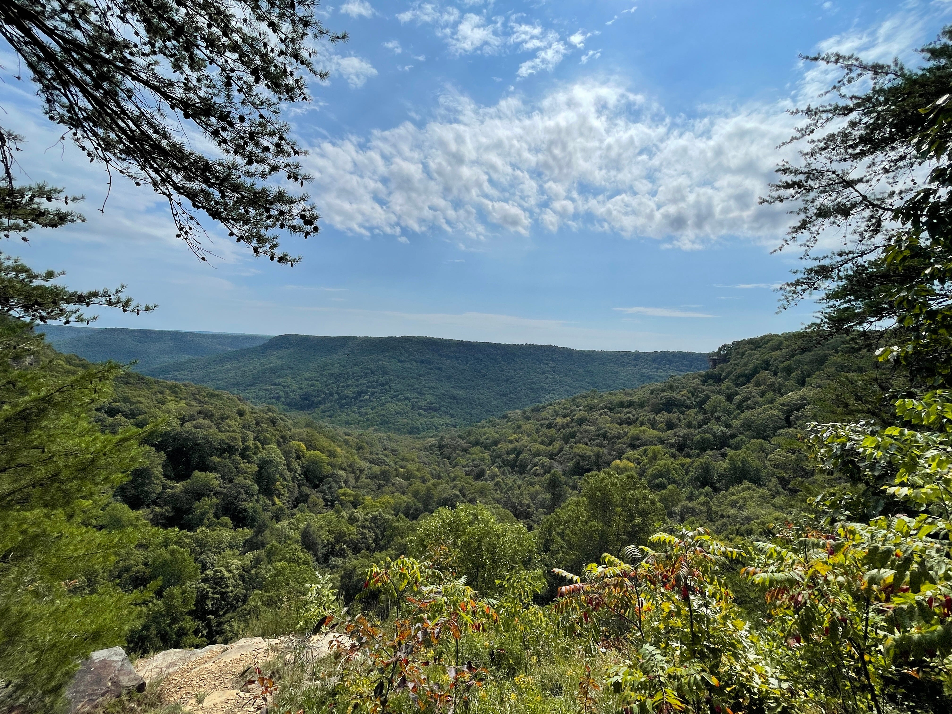
The path to the Laurel Gulf scenic overlooks was very easy. This is a high beauty to pain ratio. I would highly recommend to all ages and skill levels.
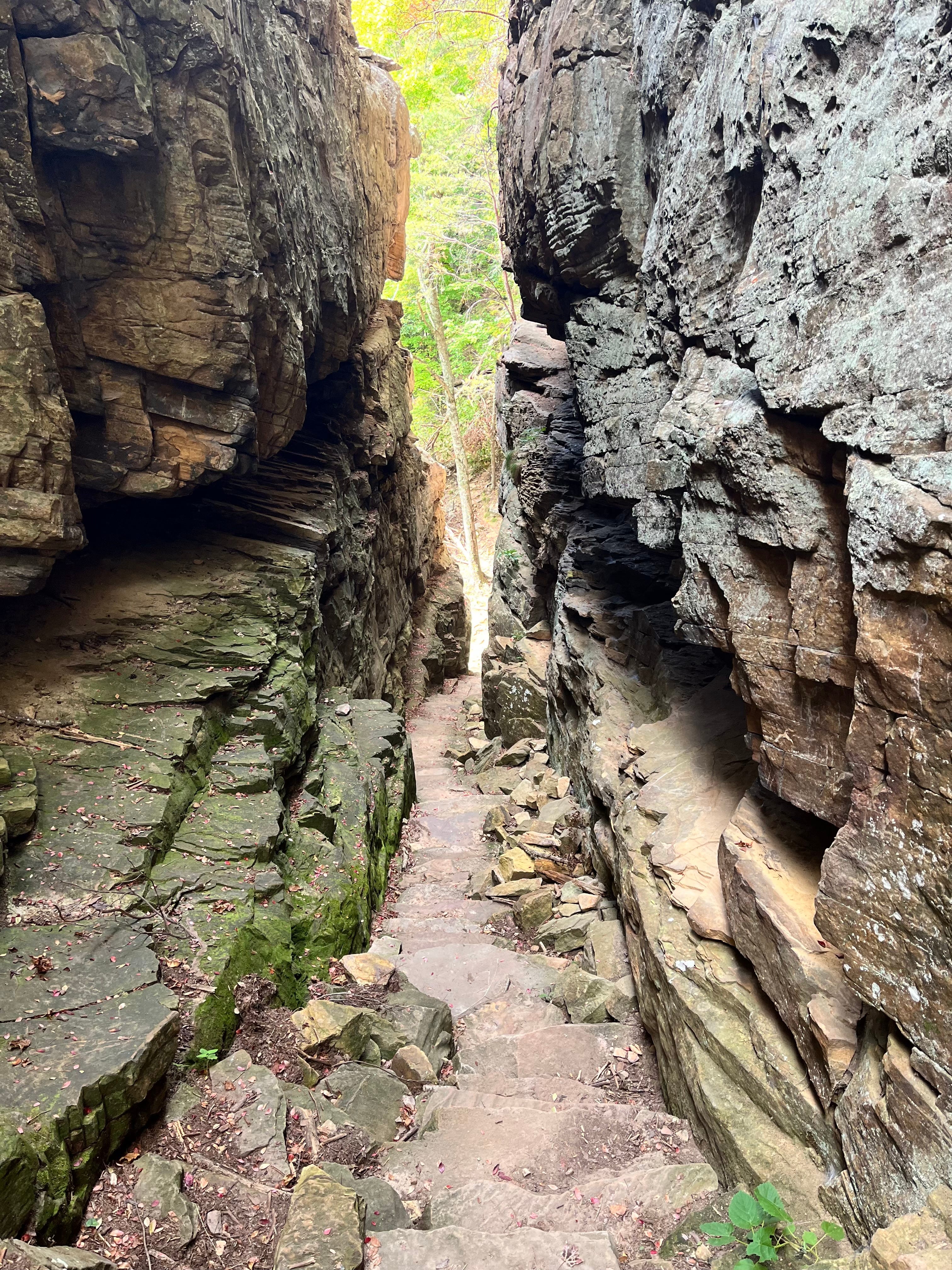
A little further on is the Stone Door. This is a 100 ft high and 10 ft wide crack in the cliff face. It is lovely and fun. To go to the Stone Door is approximately a 2 mile round trip from the Ranger station.
On the way down, we ran into a group of 20 somethings, who were in bad shape and on their way back. They were out of water and seemed to have been through some things. I parted with my extra bottle of water, and it didn’t occur to me there was a reason these fit young men were struggling.
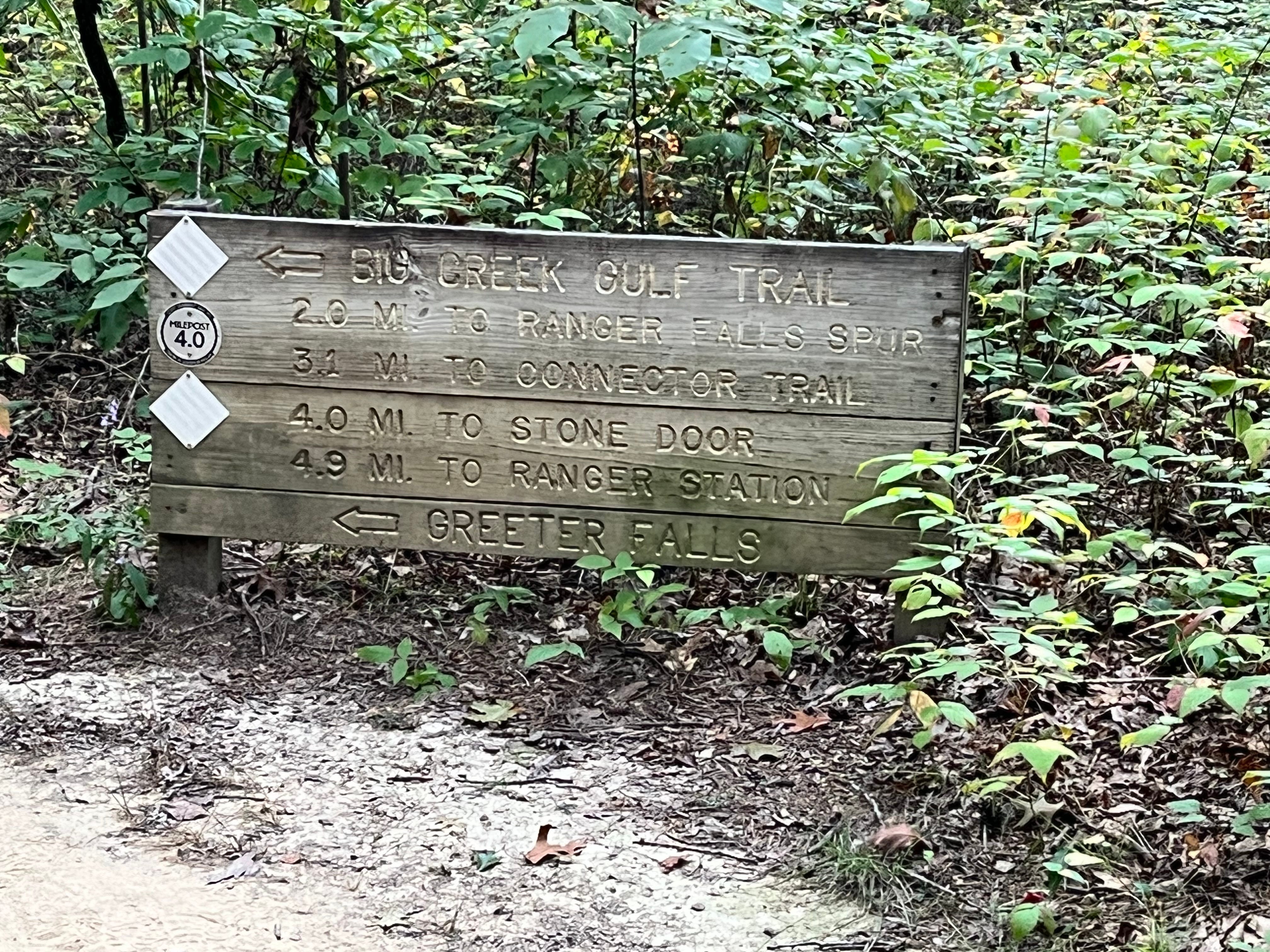
We continued down the path, and were amazed by how difficult the next two miles would be. It was a huge elevation change, descending 800 feet in less than a mile, and the trail was all rocks. There were lots of areas to lose your footing and take a long tumble. It was definitely the toughest downhill hike I have had. Eventually, at the bottom of Big Creek Gulf, it flattened out a little. We finally reached the spur to go to Ranger Falls. Normally you have to cross the Big Creek, but lucky for us this section of the creek was dry, and we were able to boulder hop over. The spur to Ranger Falls is almost a mile in and out. It was fairly easy after what we had been through!
So, we sat at Ranger Falls and pondered. Did we want to go back the way we came, with the impossible boulder trail and elevation uphill this time? Or take a chance to take a longer trails, but perhaps not as difficult? After analyzing the maps, and our memory of what we had just been through, vs what we had found on the other trail in May, we decided to not return on the same path, and to go forward on the Big Creek Gulf Trail, and meet up with the Laurel Trail back to the ranger station. It was going to be about 5 miles we thought. Well, unfortunately, the trail back was not much better than the one we had been on. Mostly vertical climb back up 800 feet over rocks. The below picture represents what we looked at for several hours.
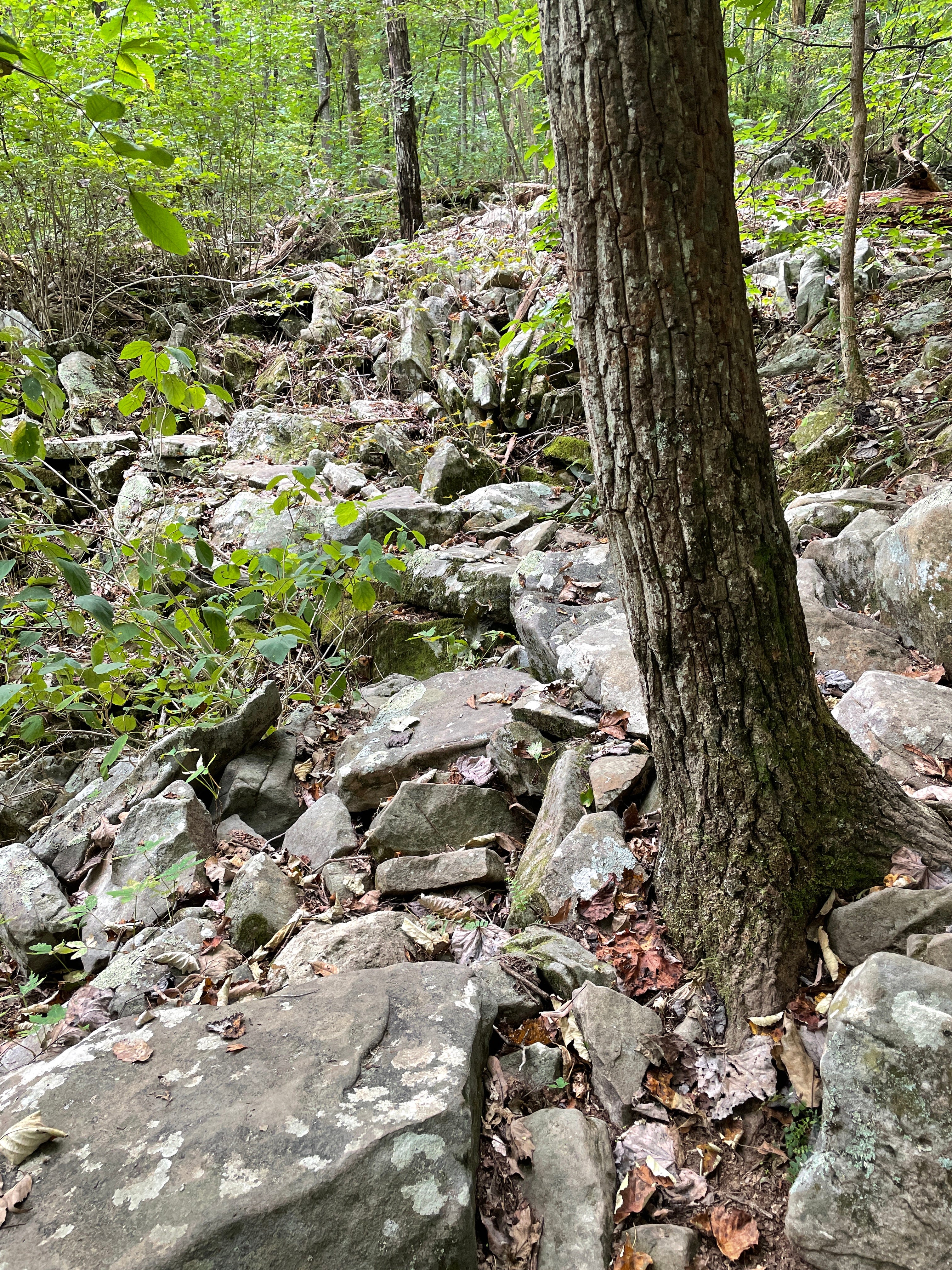
It is really hard to walk on a path like this. You find yourself constantly looking down, and for people like me with some physical limitations (arthritis in feet, etc.), this was like a march straight into hell. At some point, my foot caught a root and I took a tumble. There was blood and pain, but luckily nothing too bad! Needless to say, we did not make it back to the gift shop for that t-shirt. We stopped our hike close to the Alum Gap campground. We were never lost, but after 9 miles of hiking, I had met my match. Savage Gulf is indeed savage, and the Big Creek Gulf Trail should be treated with reverence and respect. I would suggest only seasoned hikers and those in good physical condition take this on.
I am going to leave the end of the day details to your imagination, but let’s just say that I also learned I need to pack a flashlight. And I need to accept that my daily hiking limit may be somewhere between 5 and 6 miles, unless it is a really easy trail. This means that some waterfalls on my list, I will never get to enjoy. But, I have to be realistic about my abilities, and be grateful that I am able to do what I can do and push myself with this hobby of waterfall hunting and hiking.